Category: Ontario Land Development, Zoning & Approvals
Service area: Ontario-wide
Published: September 22, 2026
Typical project stage: Draft plan approval through registration and construction
Related services: Plan of Subdivision Drawings, Site Grading Plans, Site Servicing Plans, and Stormwater Management Reports
A draft plan of subdivision establishes the proposed lots, blocks, roads, access points, and land uses. It does not, by itself, provide the construction-level information needed to service and build the community.
That work is carried by the civil engineering package.
Across Ontario, municipalities typically require detailed engineering drawings and reports to satisfy draft plan conditions, support a subdivision agreement, obtain engineering drawing approval, and advance the plan toward registration. The exact checklist varies by municipality, Region, and Conservation Authority, but the technical purpose is consistent:
Show that the proposed subdivision can be graded, serviced, drained, accessed, constructed, and maintained in accordance with municipal standards.
The civil package begins with early engineering input
Civil engineering should begin before the draft plan is treated as fixed.
At the planning stage, early engineering input can identify constraints that affect lot yield, road alignment, access, servicing feasibility, stormwater storage, and development costs. A concept that appears practical from a planning perspective may require significant changes if:
- The proposed road cannot achieve acceptable grades.
- Water or sanitary capacity is not available.
- Stormwater cannot reach a suitable outlet.
- Lots cannot be graded without retaining walls or drainage easements.
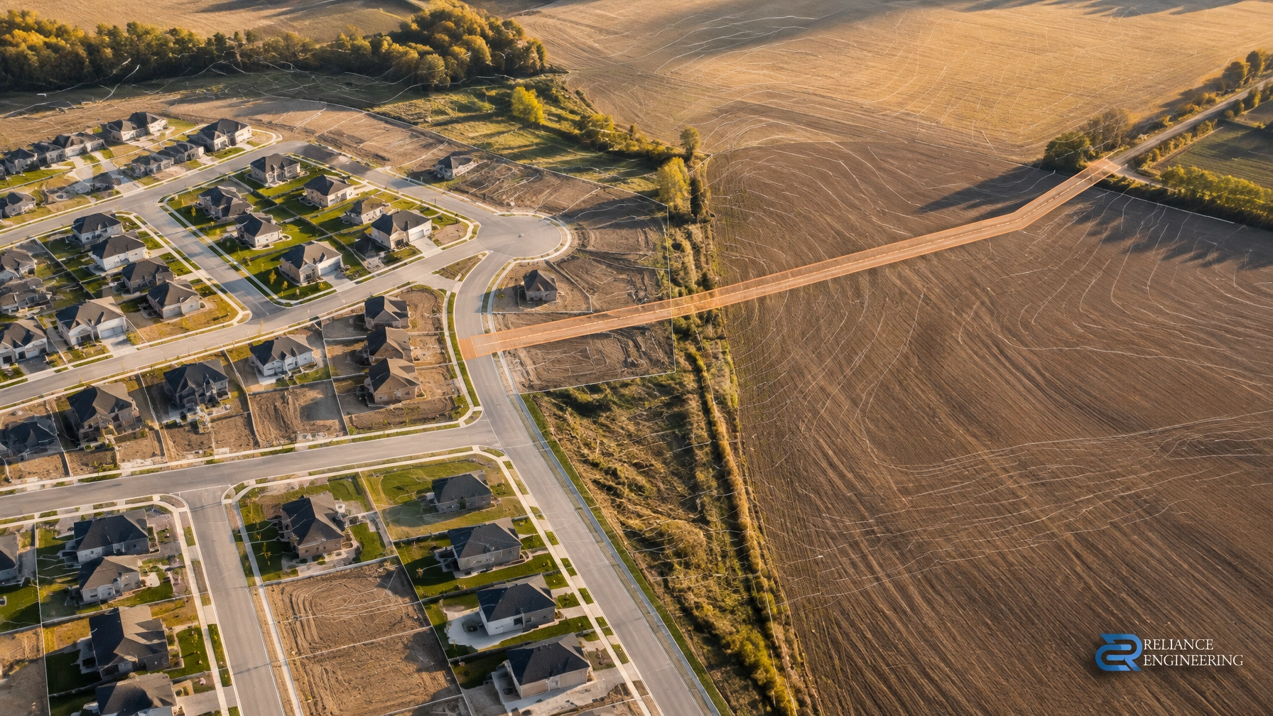
- An access connection requires a road widening or right-of-way.
- A watercourse, wetland, floodplain, or erosion hazard affects the property.
- A Conservation Authority requires additional studies or setbacks.
For this reason, OPA/ZBA drawings and preliminary subdivision drawings should include practical concepts for grading, servicing, stormwater, and access. Early feasibility work helps the planning team understand what can be carried into detailed design.
What the subdivision civil drawings need to show
A complete civil package normally includes several coordinated drawing groups. The drawings must communicate the overall design clearly to municipal reviewers, consultants, contractors, and future builders.

1. Road and right-of-way layout
The road network is the framework of the subdivision. Civil drawings should establish:
- Road alignments and right-of-way widths
- Intersections and turning areas
- Road grades and vertical profiles
- Road widenings and daylight triangles, where required
- Sidewalks, boulevards, ditches, and utility corridors
- Access connections to existing public roads
- Emergency access and fire route considerations
- Easements and connections to adjacent lands
Municipalities commonly require plan and profile drawings for subdivision roads. These show the horizontal road layout and the vertical relationship between the road, underground services, driveways, and adjacent lots.
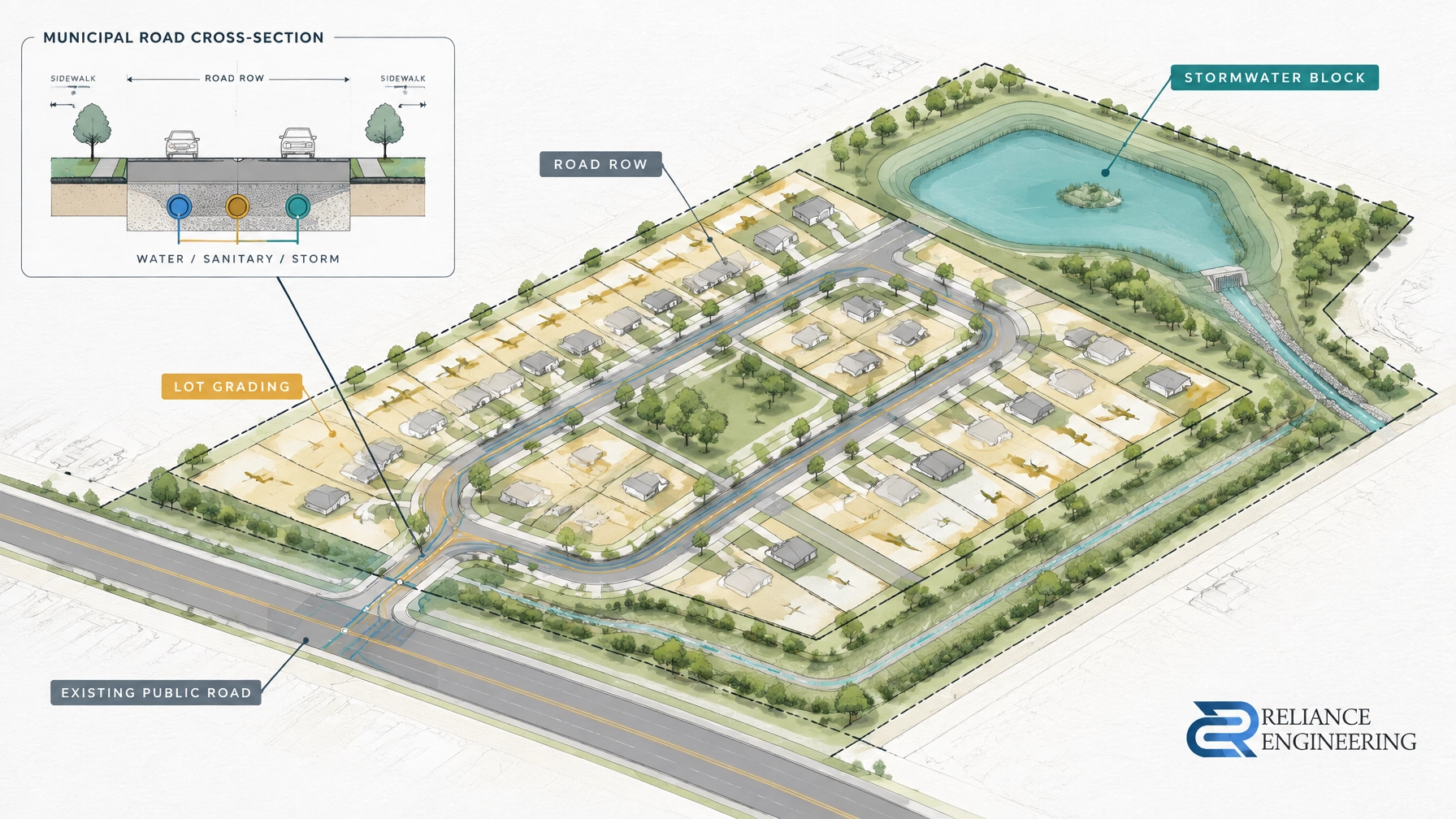
Municipal cross-sections are also important. A typical cross-section may show the road platform, pavement structure, curb, sidewalk, boulevard, utility locations, storm sewer, and grading limits. The final requirements depend on the municipality’s engineering standards and the approved subdivision design.
A road layout must work not only on paper but also in construction. Poor coordination between road grades, lot entrances, underground services, and storm drainage can create problems later.
2. Buildable grading and drainage blocks
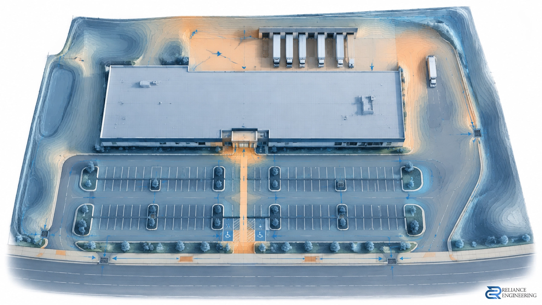
A subdivision grading plan should establish a buildable landform for the entire development. It is not simply a collection of spot elevations.
The design should show:
- Proposed road and curb elevations
- Lot and block elevations
- Finished floor or preliminary building elevations, where available
- Driveway and entrance grades
- Rear-yard and side-yard drainage
- Swales and overland flow routes
- Retaining walls, where required
- Tie-ins to adjacent properties
- Drainage easements and blocks
- Park, open-space, and reserve grading
- Major system flow routes during surcharge or extreme events
Lot grading must direct runoff toward an approved drainage system without creating impacts on neighbouring lands. Where lots cannot drain directly to the road, a drainage block, rear-yard swale, easement, or other approved solution may be required.
The grading design should also anticipate future site plan control and building permit requirements. Individual builders will later need enough information to prepare building permit drawings, building locations, driveway connections, roof drainage, and final lot grading.
A practical grading plan reduces the risk of ponding, basement elevation conflicts, inaccessible driveways, and changes during construction.
Water, sanitary, and storm servicing must work as one system
Subdivision servicing drawings show how the proposed community connects to municipal infrastructure.
The core systems normally include:
- Watermain alignment, sizing, valves, hydrants, and connections
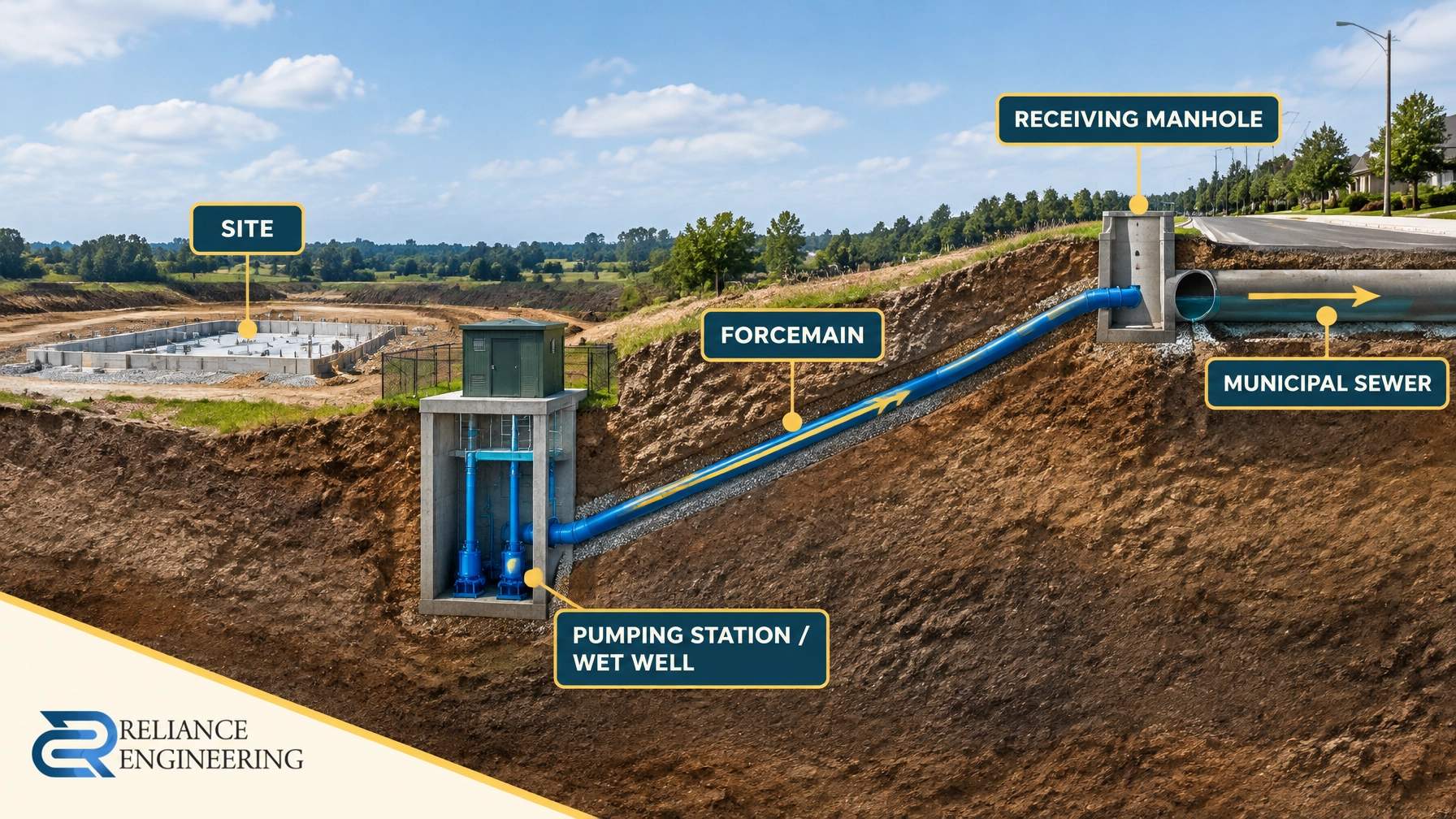
- Sanitary sewers, manholes, laterals, and drainage areas
- Storm sewers, catchbasins, manholes, inlets, and outlets
- Utility corridors and easement requirements
- Service connections to lots and blocks
- Phasing and temporary servicing, where applicable
- Extensions to subdivision limits for future development
- Conflicts with existing infrastructure and utilities
These drawings should be coordinated with the Functional Servicing Report. The report explains whether the proposed water, sanitary, and storm systems can support the development. The drawings then show how those systems will be laid out and constructed.
Strong coordination is essential. Pipe slopes, road grades, lot elevations, storm sewer inverts, basement elevations, and utility corridors all affect one another. A servicing layout that ignores grading or future building locations may require redesign during detailed engineering.
The stormwater management block and outlet are critical
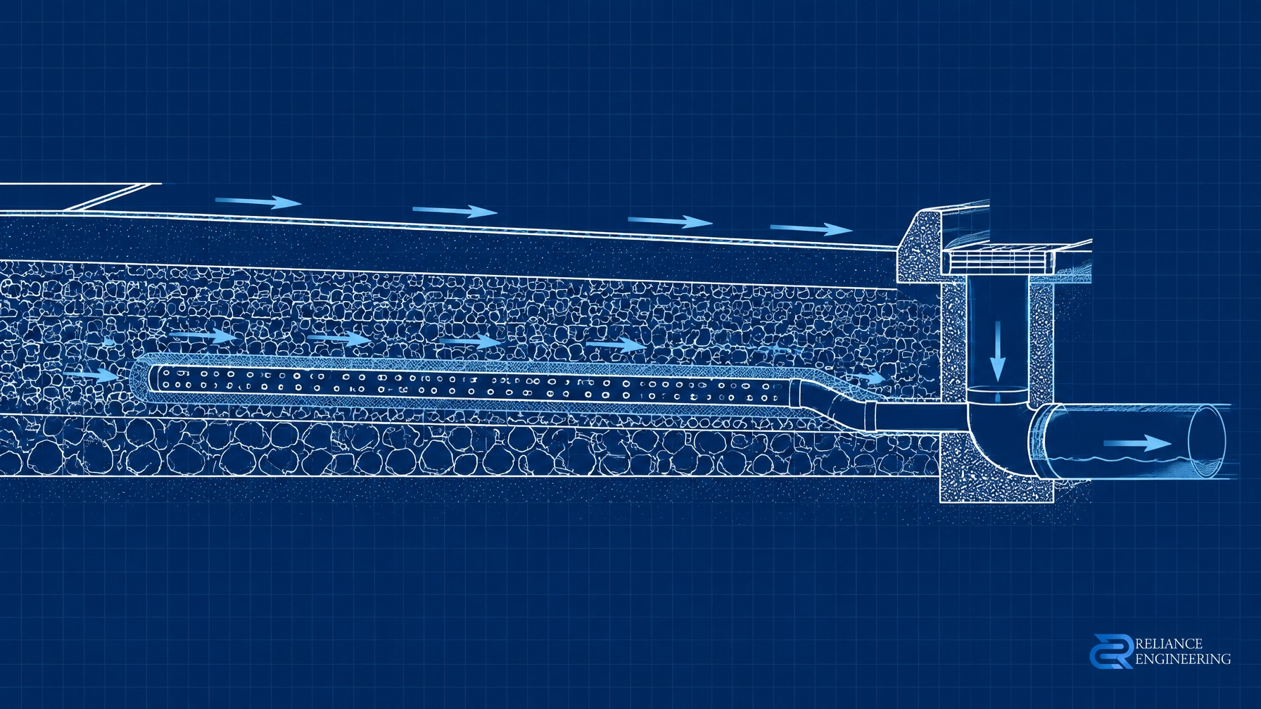
Many subdivisions require a dedicated stormwater management block. This block may contain a wet pond, dry pond, underground storage system, infiltration feature, control structure, outlet channel, or related infrastructure.
The civil and stormwater package should identify:
- The stormwater management block limits
- Pre-development and post-development drainage areas
- Storage requirements
- Quantity control targets
- Water quality treatment measures
- Inlet and outlet structures
- Emergency spill routes
- Maintenance access
- Outlet connection to a municipal system, ditch, watercourse, or other approved location
- Overland flow routes
- Construction-phase erosion and sediment controls
The outlet is often one of the most important design constraints. Storage is only useful if water can be released safely and within the applicable municipal and Conservation Authority criteria.
A Stormwater Management Report should support the design with runoff calculations, storage requirements, release rates, outlet control details, and overland flow assessment. Where the subdivision affects a regulated watercourse, wetland, valley, floodplain, or erosion hazard, Conservation Authority review may also be required.
Erosion and sediment control protects the approval and construction process
Subdivision construction exposes large areas of soil. An Erosion and Sediment Control Plan should be coordinated with the grading and storm servicing design.
The plan may include:
- Construction access and mud mats
- Silt fencing
- Catchbasin protection
- Sediment traps
- Stockpile controls
- Construction limit fencing
- Temporary drainage routes
- Dewatering controls
- Inspection and maintenance notes
These controls protect municipal roads, storm sewers, ditches, watercourses, neighbouring properties, and downstream systems. Municipalities and Conservation Authorities may require revisions if the proposed controls do not match the construction sequence or drainage pattern.

How the drawings support draft plan conditions
Draft plan approval is commonly issued with conditions. These conditions may require detailed reports, engineering drawings, agency clearances, easements, road dedications, servicing commitments, and execution of a subdivision agreement.
The civil package helps address conditions related to:
- Road and right-of-way design
- Water, sanitary, and storm servicing
- Lot and block grading
- Stormwater management
- Erosion and sediment control
- Access and drainage easements
- Municipal infrastructure connections
- Construction cost estimates and securities
- Conservation Authority requirements, where applicable
- Engineering drawing approval
The municipality’s engineering department reviews the drawings against its development standards, approved studies, draft plan conditions, and comments from other agencies.
A submission that is complete, coordinated, and easy to review can reduce avoidable review cycles. Reviewer-friendly drawings should include clear notes, legends, key plans, dimensions, elevations, utility information, design references, and professional seals where required.
The subdivision agreement and engineering drawing approval
Approved engineering drawings are typically referenced in the subdivision agreement. The agreement establishes the developer’s obligations for constructing roads, services, stormwater facilities, grading works, landscaping interfaces, and other municipal infrastructure.
The agreement may also address:
- Construction timing and phasing
- Municipal inspection
- Securities and cost estimates
- Easements and land transfers
- Maintenance responsibilities
- As-constructed drawings
- Assumption of infrastructure by the municipality
Engineering drawing approval is therefore more than a technical formality. It confirms that the proposed works are sufficiently defined for the municipality to secure construction obligations and review the development during construction.
The plan of subdivision survey plan and the civil engineering drawings serve different purposes. The survey plan establishes the legal lots, blocks, and rights-of-way for registration. The civil drawings explain how those lots and public systems will function.
Registration does not replace later approvals
Registration is an important milestone, but it does not remove the need for later approvals.
Depending on the project, future stages may include:
- Site plan control and site plan approval
- Final lot grading
- Building permit drawings
- Building permit review
- Detailed utility coordination
- Construction inspections
- As-constructed documentation
- Municipal assumption
Individual lots may also require additional grading, servicing, or stormwater information. A subdivision drawing set should therefore provide a sound framework for future building permit drawings and builder coordination.
A land severance Ontario application is usually smaller in scale, but it relies on the same basic civil questions: Can the proposed lots be accessed, graded, serviced, and drained without creating impacts? The difference is that a plan of subdivision must coordinate an entire road and infrastructure network.
Prepare the civil package before the conditions become a delay
A successful subdivision requires more than a strong concept plan. It requires coordinated technical information that can satisfy planning conditions, support a subdivision agreement, receive engineering approval, and guide construction.
Reliance Engineering prepares practical, clear, and coordinated civil drawings for land development projects across Ontario. Our work can include road and right-of-way layouts, grading and drainage blocks, water/sanitary/storm servicing, stormwater management, erosion and sediment control, and approval support through municipal review.
Planning a plan of subdivision in Ontario? Request a consultation before finalizing the draft plan. Early engineering input can identify servicing, grading, access, and stormwater constraints before they become approval issues.
Request a Consultation or contact Reliance Engineering directly.
Contact Reliance Engineering
Naresh Ochani, P.Eng. M.Eng.
PEO Certificate of Authorization 100548882
Reliance Engineering
6850 Millcreek Dr, Mississauga, ON L5N 2H4
Phone: 647-385-6418
Email: [email protected]
Office hours: Saturday 12:00 PM–2:00 PM; Sunday Closed.
Ontario approval references
Municipal requirements vary across Ontario. Confirm the current submission checklist, engineering standards, draft plan conditions, and agency requirements for the applicable municipality and Conservation Authority.