Ontario Site Servicing & Stormwater | Stormwater management reports
Prepared by Reliance Engineering Canada Limited
A stormwater management report can demonstrate that on-site storage and the allowable release rate meet municipal criteria, and still receive review comments. The missing piece is often a continuous, safe, and legally available route for overland flow to reach an outlet.
Quantity control answers how much runoff leaves a site during a storm. Safe conveyance answers where water exceeding the minor system goes, how deep and fast it flows, and whether the route crosses land the applicant has a right to use.
Quantity control is not the whole report
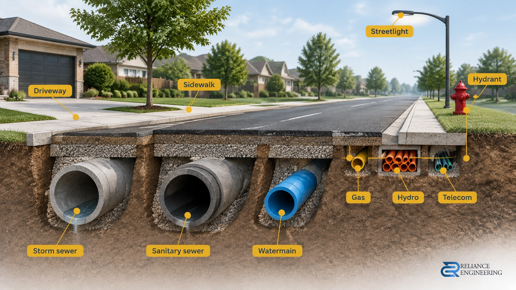
The minor system, storm sewers and inlets, handles runoff up to its design capacity. The major system (surface routes such as swales, roads, parking areas, and emergency spillways) conveys flows that exceed that capacity.
The design storms are set by local criteria, not by one province-wide rule. For example, the City of Mississauga’s Development Requirements Manual, Section 8 – Storm Drainage Design Requirements (effective April 2025) calls for storm sewers designed for the 10-year storm, and trunk systems draining 100 hectares or more designed for the 25-year storm. Hamilton’s February 2026 stormwater report checklist asks whether the minor system was designed for the 1-in-5-year event.
These are municipal examples, not Ontario-wide standards. Confirm the governing municipality’s and Conservation Authority’s criteria, design storms, and limits before establishing the drainage strategy. The MECP Stormwater Management Planning and Design Manual provides general guidance; local criteria still govern project-specific review.

A quantity-control calculation does not establish a safe major-system route. That route needs a defined start, continuous grades, a receiving outlet, and a clear demonstration of safe conveyance. It is often discovered late: after building, parking, and servicing layouts have been treated as fixed.
What reviewers test the route against
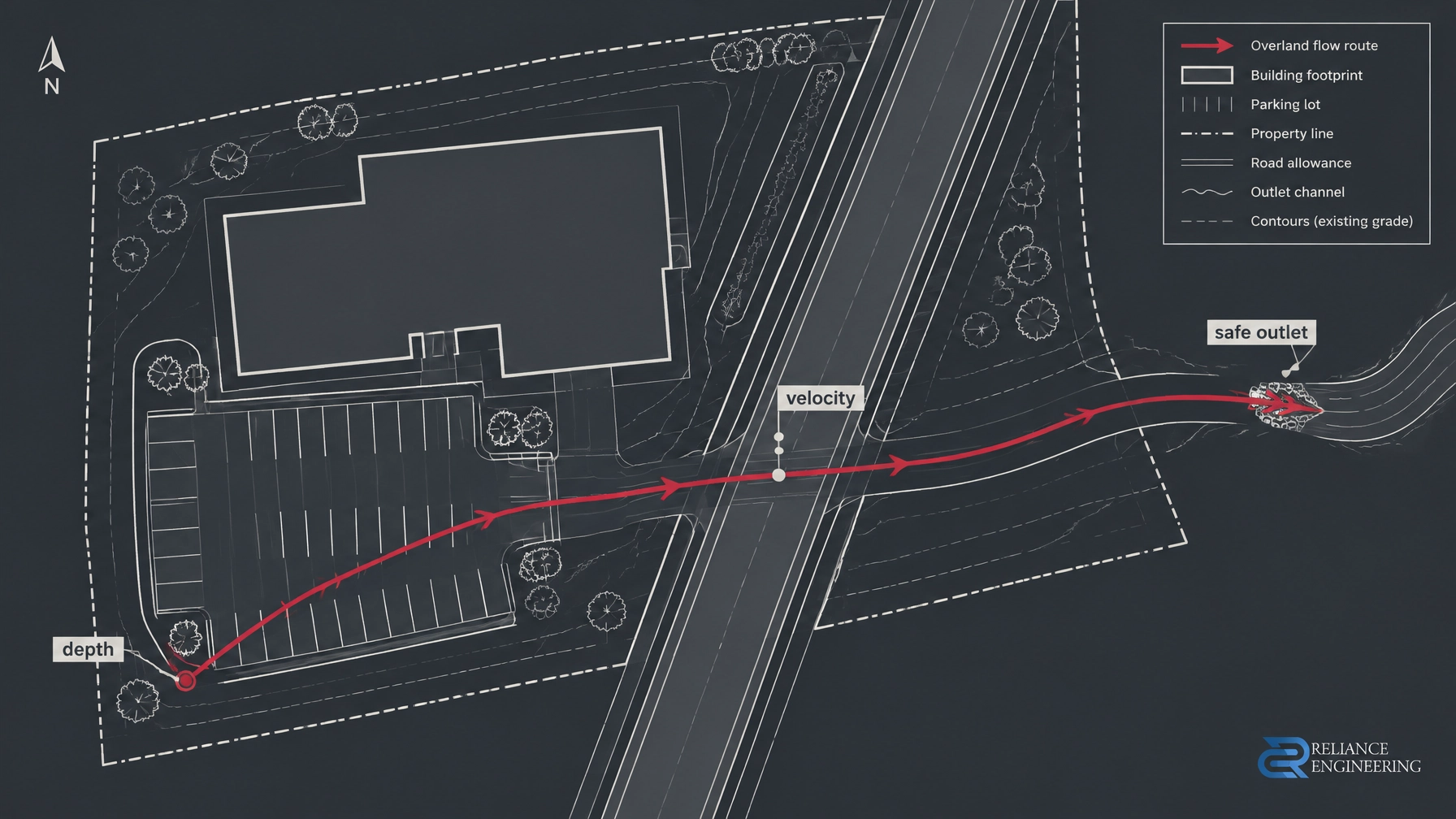
Mississauga’s Section 8 provides a useful worked example of safe-conveyance checks. It requires a continuous overland route to the nearest major channel through all areas, contained within a road right-of-way or easement. The manual identifies positive major-system overland flow as a paramount consideration.
For Mississauga, the review includes whether:
- A building is inundated at ground level during the 100-year storm, unless it is flood-proofed.
- At road gutters, water depth in metres multiplied by velocity in metres per second stays within 0.65 m²/s.
- On arterial roads, water depth remains below the road crown.
- Flow is kept from crossing road intersections during minor storms.
- Road low points have a safe overland-flow provision.
- Major-system channels for new development accommodate the greater of the Regional Storm or 100-year storm.
- Parking-lot and landscape grades provide a safe path to the right-of-way for storms exceeding the design event.
Mississauga requires a Professional Engineer-signed analysis. Depending on complexity and downstream constraints, this may be a spreadsheet-style analysis or dual-drainage modelling.
Other municipalities apply different tests. Hamilton’s February 2026 checklist, for example, caps surface ponding at 0.25 m in parking areas and 0.30 m in loading bays. Those are Hamilton criteria, not province-wide limits.
Eight questions that can come back as comments
Hamilton’s Storm Water Management Report/Plan Development Application Guidelines and summary checklist (updated February 2026) is a practical reminder of what reviewers need to see:
- Where does the major overland route outlet, and is it clearly shown on the supporting drawings?
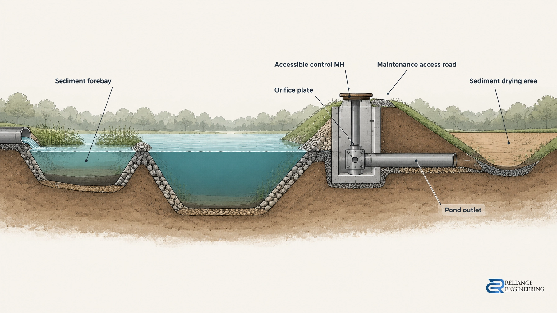
- Is the emergency spillway from the site or facility defined and connected to a receiving system?
- Are flow depths and velocities shown at key road locations and outfalls?
- Is a downstream drainage easement needed, and is it shown on the grading and servicing plans?
- Are downstream landowners obligated to accept the proposed upstream discharge?
- At a watercourse outlet, are erosion protection and outlet-invert conditions addressed, and is a Conservation Authority permit required or underway?
- Is drainage fully contained in proposed conditions? If not, where does uncontrolled drainage go?
- Is the 100-year ponding extent shown on the grading plan?
These are the kinds of questions that surface when a route has not been fully designed.
The outlet problem
An overland route must lead to a place where the site has a legal right to discharge. Possible outlets include a municipal storm system with capacity, a municipal drain or channel, a watercourse, or an overland route across private downstream property secured by an easement.
A line or arrow leaving the property boundary in an SWM report is not, by itself, an outlet. If the only route crosses a neighbour’s land, the design is not complete until the required easement is secured and shown on the drawings. Where a watercourse or regulated area is involved, Conservation Authority review and a permit may also apply.
Downstream conditions can govern the design. A surcharged system or a watercourse with erosion concerns may limit discharge or require additional measures. Confirm the receiving system’s capacity and condition, rather than checking only the pipe at the property line.

Design the grading route before the hydraulics are finalized
Overland flow is first a grading problem. Building finished-floor and opening elevations must be set relative to the spill elevation and the applicable major-storm water level. Parking areas and swales need grades that steer water toward a relief route rather than trap it against a curb.
Do not rely on one inlet or a single sag without a secondary path. Prevent block flow from crossing side and rear lot lines. Detail erosion protection and energy dissipation at each outfall; a general note is not a substitute for a designed detail.
Underground storage, roof connections, and foundation connections do not remove the need for an emergency route. If a control clogs or rainfall exceeds the design event, surface flow still needs somewhere safe to go. Clear, buildable grading should make that route apparent in the field as well as in the calculations. See our site grading plans and stormwater management reports.
How the route gets lost between drawings
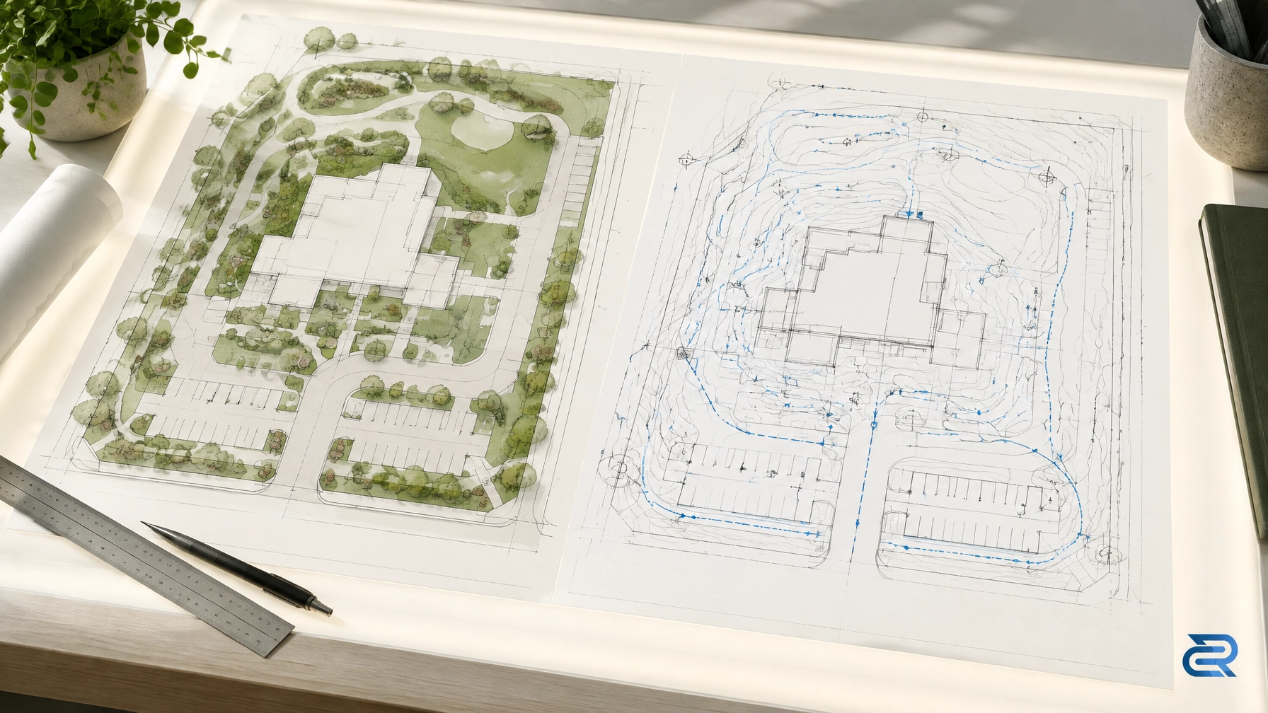
The SWM report, grading plan, site servicing plans, functional servicing report, and erosion and sediment control plan must describe the same drainage strategy.
Common mismatches include a report showing an overland route through a landscaped area that the grading plan fills; a servicing plan showing an overflow connection without a downstream surface route; or ponding extents in the SWM report that do not match the grading contours. A functional servicing report for a larger or phased application should also align with the proposed SWM route.
Clean layouts, coordinated design, constructible routing, and clear calculations help the reviewer trace the route from its starting point to its outlet. That clarity supports a first-pass review; it does not replace confirmation of the applicable local criteria.
Pre-submission check
Before fixing the design, the developer and design team should:
- Obtain the governing criteria document and confirm its minor- and major-system design storms.
- Trace one continuous route from the farthest low point to a legal outlet.
- Check depth × velocity and depth relative to road crown at each applicable road section.
- Confirm that buildings, openings, and basements are protected from the spill and relevant major-storm level.
- Check downstream system capacity and condition, not only the connection at the property line.
- Identify easement, Conservation Authority, MTO, or railway requirements early, where applicable.
- Show ponding extent, spill elevation, and emergency spillway on the drawings as well as in the report.
- Check that grading, servicing, and SWM drawings agree line for line.
Where the route fits in approvals
Site plan control and plans of subdivision both involve municipal civil review of grading, servicing, and stormwater management. Larger or phased applications may also require a functional servicing report that supports the proposed route. Conservation Authority review may apply where a watercourse, floodplain, or regulated area is involved.
Municipal experience matters because an approach accepted in one municipality may prompt comments in another. Criteria, design storms, and limits vary by municipality and Conservation Authority; confirm them for the specific site before submission.
Key takeaways
- Meeting an allowable release rate does not prove safe overland conveyance.
- The major route must be continuous, assessed, and connected to an available outlet.
- Depth, velocity, ponding, building elevations, and downstream effects are local-criteria questions.
- A route across private land requires the necessary legal permission, not just a line on a plan.
- The report, grading, servicing, and functional servicing documents must tell the same story.
- Early review of the outlet can prevent late redesign and approval delays.
Planning a development or preparing a submission? Request a consultation with Reliance Engineering to discuss your stormwater management report and overland-flow route.
Professional credentials and contact
Naresh Ochani, P.Eng. M.Eng.
Principal Engineer, Reliance Engineering Canada Limited
PEO Certificate of Authorization: 100548882
6850 Millcreek Dr, Mississauga, ON L5N 2H4
Phone: 647-385-6418
Email: [email protected]
Office hours: Monday to Friday 9:00 AM–5:00 PM; Saturday 12:00 PM–2:00 PM; Sunday closed.