Published: October 7, 2026
Focus: Ontario Land Development, Zoning & Approvals
Service Area: Ontario
Primary Services: Severance/Consent Application Drawings, OPA/ZBA Drawings, Site Plan Approval Drawings, Plan of Subdivision Drawings
Dividing land in Ontario is not only a question of drawing a new lot line. The approval route affects the planning process, technical studies, servicing strategy, access requirements, municipal conditions, and future building permit work.
For a limited land division, a consent to sever may be appropriate. For a multi-lot development requiring coordinated roads, infrastructure, stormwater management, or parkland, the municipality may require a plan of subdivision.
Choosing the correct route early helps avoid redesign, duplicated studies, and preventable municipal comments.
Consent to Sever: When It Is Usually Appropriate
A consent application, commonly called a land severance in Ontario, is generally used to create one new lot from an existing parcel. It may also apply to:
- A lot addition
- The creation or adjustment of a right-of-way
- An easement
- A boundary adjustment
- Certain lease or mortgage arrangements affecting part of a property
The application is typically reviewed by a Committee of Adjustment, council, planning board, or another delegated approval authority. The exact process depends on the municipality and local planning structure.
A consent may be suitable where:
- One new lot is proposed
- The severed and retained parcels have practical dimensions
- Both parcels comply with the official plan or can reasonably achieve conformity
- Zoning requirements are met or can be addressed
- Each lot has acceptable frontage and access
- Water and sanitary servicing are feasible
- Drainage and grading can be managed without harming adjacent properties
- No new internal road network is required
A consent is not automatically the simpler option. The approval authority can determine that a plan of subdivision is necessary for the proper and orderly development of the land.
The Ontario government’s Citizen’s Guide to Land Severances and Consents explains the broader planning considerations. Local official plans, zoning by-laws, engineering standards, and pre-consultation requirements must also be reviewed.
Plan of Subdivision: When a Coordinated Development Is Required
A plan of subdivision is generally the correct route when several new lots or a coordinated development pattern is proposed.
It may be required where the project involves:
- Multiple new residential or commercial lots
- A new public or private street
- Shared servicing infrastructure
- Coordinated stormwater management
- Parkland or cash-in-lieu requirements
- New easements or utility corridors
- Road widenings
- Phased development
- Complex access arrangements
- Infrastructure that must be secured through a subdivision agreement
The process normally begins with a draft plan submission to the designated approval authority. The authority circulates the proposal to municipal departments, agencies, utilities, Conservation Authorities where applicable, and other stakeholders.
Draft approval conditions may address:
- Road construction
- Municipal water and sanitary services
- Storm sewers and stormwater facilities
- Grading and drainage
- Parkland dedication
- Street names
- Easements
- Environmental requirements
- Zoning
- Development agreements
- Financial securities
The subdivision process is more comprehensive because it must show how the entire development will function, not only how individual lots will be created.
Ontario’s subdivision guidance and O. Reg. 544/06 provide additional provincial context. Municipal requirements remain decisive.

The Number of Lots Is Only the First Test
The number of proposed lots is important, but it is not the only factor.
A single severed lot may still require a more detailed planning and engineering approach if it depends on:
- A shared driveway
- A private right-of-way
- A new road connection
- A major drainage outlet
- A stormwater management facility
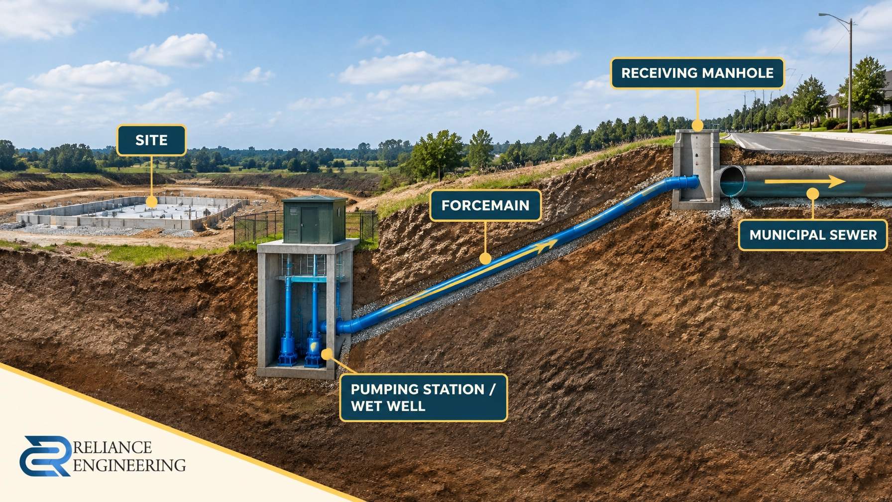
- A new sanitary pumping arrangement
- A significant grading transition
- An easement through the retained lands
- A Conservation Authority review
Conversely, a small land adjustment may remain appropriate for consent if it does not create a new building lot or require coordinated infrastructure.
The practical question is:
Can the proposed parcels function independently under the municipality’s planning, access, servicing, grading, and environmental requirements?
If the answer depends on a coordinated network serving several lots, a plan of subdivision is more likely to be required.
Right-of-Way, Frontage and Access Can Decide the Route
Access is a central issue in both consent and subdivision applications.
For a consent, the municipality will typically want to understand:
- Whether the severed and retained parcels front on a public road
- Whether the road is municipal, private, seasonal, or provincial
- Whether each parcel has legal and practical access
- Whether a new driveway entrance is permitted
- Whether access is through a right-of-way
- Whether the right-of-way is wide enough and legally registered
- Whether emergency, construction, and maintenance access is possible
- Whether driveway grades and sightlines are acceptable
A right-of-way is not automatically unacceptable. However, it must work legally, physically, and from a municipal engineering perspective.
A proposal that creates several lots along a private access road may require a coordinated road design, servicing strategy, maintenance arrangement, and subdivision approval. A narrow shared driveway serving one additional lot may be addressed through consent, depending on local policy and site conditions.
The civil drawings should show the relationship between property lines, frontage, driveway locations, road limits, rights-of-way, easements, utilities, and drainage.
Servicing Must Be Proven Before Approval
A consent is not a way to avoid servicing constraints.
For each proposed parcel, the application should identify how the property will receive:
- Municipal water
- Municipal sanitary service
- Private well service
- Private septic service
- Communal servicing, where applicable
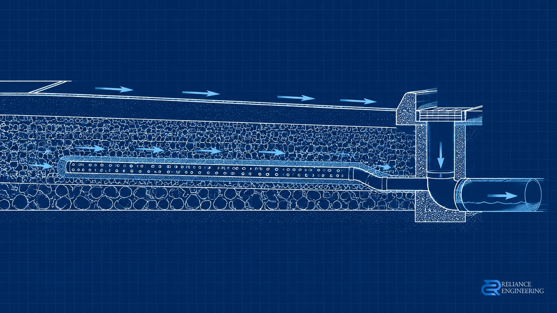
- Storm drainage and overland flow management
In serviced settlement areas, municipal water and sanitary infrastructure are generally preferred where available and feasible. Where municipal services are not available, hydrogeological, septic, environmental, or other technical information may be required.
For a consent, the civil package should confirm that both the severed and retained parcels can be serviced without creating conflicts. This includes reviewing existing services that may cross the proposed lot line.
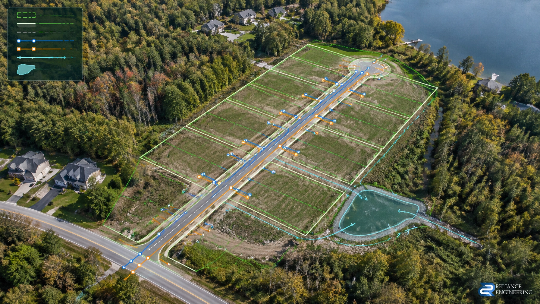
For a subdivision, the design must usually address the full servicing network, including:
- Watermain layout
- Sanitary sewer layout
- Storm sewer layout
- Service connections
- Road cross-sections
- Stormwater management facilities
- Easements and utility corridors
- Phasing and connection points
- Downstream capacity
Our Site Plan Approval Drawings and broader civil engineering services support this type of coordinated design.
What the Civil Drawings Must Prove
The civil drawings should match the approval route and the level of development proposed.
Consent or Severance Drawings
A consent package may need to show:
- Existing and proposed lot lines
- Severed and retained parcel areas
- Frontage and access
- Existing and proposed buildings
- Building envelopes
- Driveway locations
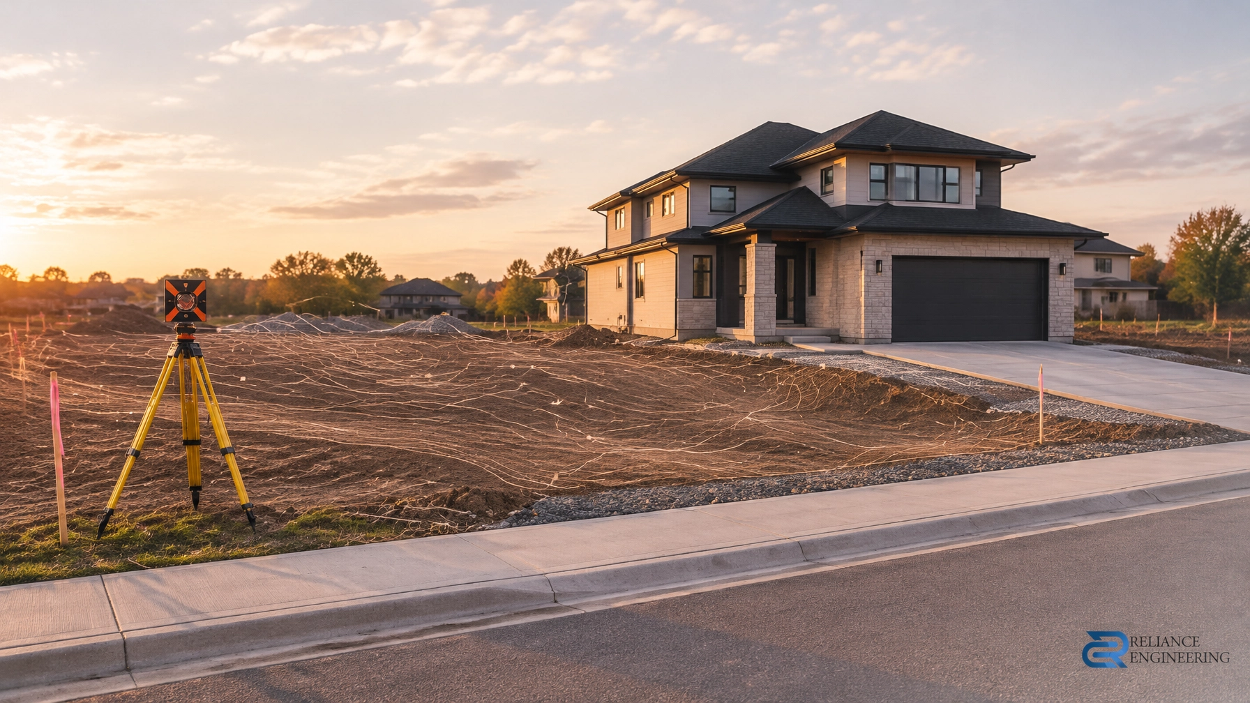
- Grading concepts
- Drainage patterns
- Water and sanitary servicing
- Stormwater discharge
- Easements and rights-of-way
- Constraints affecting future building permits
Our Severance/Consent Application Drawings focus on the practical function of both parcels, not only the proposed severed lot.
Plan of Subdivision Drawings
A subdivision civil package typically requires a more complete development framework, including:
- Draft lot layout
- Road and right-of-way widths
- Street connections
- Water, sanitary, and storm sewer networks
- Stormwater management facilities
- Grading and overland flow routes
- Servicing constraints
- Easements
- Parkland or open-space considerations
- Construction staging or phasing
- Municipal infrastructure connections
The drawings must support the planning case and provide a practical basis for detailed design, subdivision conditions, and future site plan approval.

When OPA/ZBA Drawings or Site Plan Approval Are Also Needed
The land division approval does not always authorize the final development.
A consent or subdivision application may need to be supported by a:
- Zoning by-law amendment
- Official Plan Amendment
- Minor variance
- Site plan approval
- Development agreement
- Conservation Authority review
- Building permit application
If the proposed lots do not meet the current zoning standards, OPA/ZBA Drawings can help demonstrate how the concept will be graded, serviced, accessed, and drained.
After the land division and planning permissions are in place, site plan approval may be required for commercial, industrial, institutional, townhouse, apartment, or other controlled development.
The final construction stage may then require building permit drawings showing grading, drainage, servicing, driveway slopes, stormwater details, and municipal connections.
Conservation Authority Considerations
A Conservation Authority may become involved where the property includes or is near:
- A watercourse
- Wetlands
- Valleylands
- Shorelines
- Floodplain areas
- Steep slopes
- Natural heritage features
- Regulated hazardous lands
The Authority may require additional setbacks, studies, erosion controls, floodplain analysis, or permission before development proceeds.
Where applicable, a Stormwater Management Report and Erosion and Sediment Control Plan should be coordinated with municipal and Conservation Authority requirements.
A Practical Route Selection Checklist
Start with a consent pre-consultation when:
- One new lot or a lot addition is proposed
- Existing road access is suitable
- Servicing is available or independently feasible
- No new road network is required
- The lots meet local planning and zoning policies
- Grading and drainage are straightforward
Start with a plan of subdivision pre-consultation when:
- Several new lots are proposed
- New streets or shared infrastructure are required
- Stormwater management must serve multiple parcels
- Parkland, easements, or phasing are involved
- Access depends on a coordinated road system
- The project requires substantial planning amendments
- Municipal infrastructure capacity must be assessed
When the route is uncertain, early engineering input is more efficient than designing a full application around the wrong approval structure.
Choose the Approval Route Before Detailed Design
The correct route depends on more than the desired number of lots. Frontage, access, right-of-way conditions, grading, servicing, stormwater, zoning, official plan policies, and environmental constraints all influence the municipality’s decision.
Reliance Engineering provides early engineering input, practical concepts, complete civil packages, reviewer-friendly drawings, and approval support for land severances, consent applications, subdivisions, OPA/ZBA applications, site plan approval, and building permits across Ontario.
Contact Reliance Engineering for a free consultation before you finalize your land division concept.
Contact and Professional Credentials
Naresh Ochani, P.Eng. M.Eng.
PEO Certificate of Authorization: 100548882
Authorized by the Association of Professional Engineers of Ontario to offer professional engineering services.
Reliance Engineering
6850 Millcreek Dr
Mississauga, ON L5N 2H4
Phone: 647-385-6418
Email: [email protected]
Website: www.relianceengineering.ca
Office hours:
Monday–Friday: 9:00 AM–5:00 PM
Saturday: 12:00 PM–2:00 PM
Sunday: Closed