Article type: Expert guide / land development thought leadership
Primary service: Plan of Subdivision drawings in Ontario
Prepared by: Reliance Engineering Canada Limited
Focus: Coordinated civil design, municipal review, and early engineering input
A plan of subdivision is more than a lot layout. It must demonstrate how proposed lots, roads, drainage, stormwater infrastructure, utilities, easements, and construction phases will function together.
For developers, planners, builders, architects, and landowners, civil engineering input is important before the draft plan becomes difficult to change. A coordinated design can identify servicing constraints, grading problems, road limitations, and stormwater requirements early.
Reliance Engineering prepares a complete civil package with practical concepts, reviewer-friendly drawings, and approval support for subdivision projects across Ontario.
What a Complete Civil Package Must Show
A subdivision application typically combines planning, legal, environmental, transportation, servicing, and engineering information. The civil package must explain how the proposed development can be constructed and connected to existing infrastructure.
Depending on the municipality and project scope, subdivision civil drawings may include:
- Overall grading and lot grading plans
- Road plans and profiles
- Watermain and sanitary sewer layouts
- Storm sewer and drainage plans
- Stormwater management facility plans
- Erosion and sediment control plans
- Road and driveway tie-ins
- Easements and utility corridors
- Overland flow routes
- Construction phasing plans
- Design details and municipal notes
The legal draft plan is generally prepared by an Ontario Land Surveyor. The civil drawings explain whether that layout is technically practical and how each lot, block, road, and drainage feature will work.
A change to lot lines, road geometry, block sizes, or easements can affect grading, servicing, stormwater storage, and construction costs. Strong coordination between the surveyor, planner, civil engineer, architect, and other consultants helps prevent late-stage redesign.

Early Engineering Input Keeps the Draft Plan Moving
Many subdivision concepts begin with a preferred arrangement of lots, roads, parks, and development blocks. However, the most efficient planning layout is not always the most practical engineering layout.
Early engineering input helps answer key questions before the draft plan is advanced:
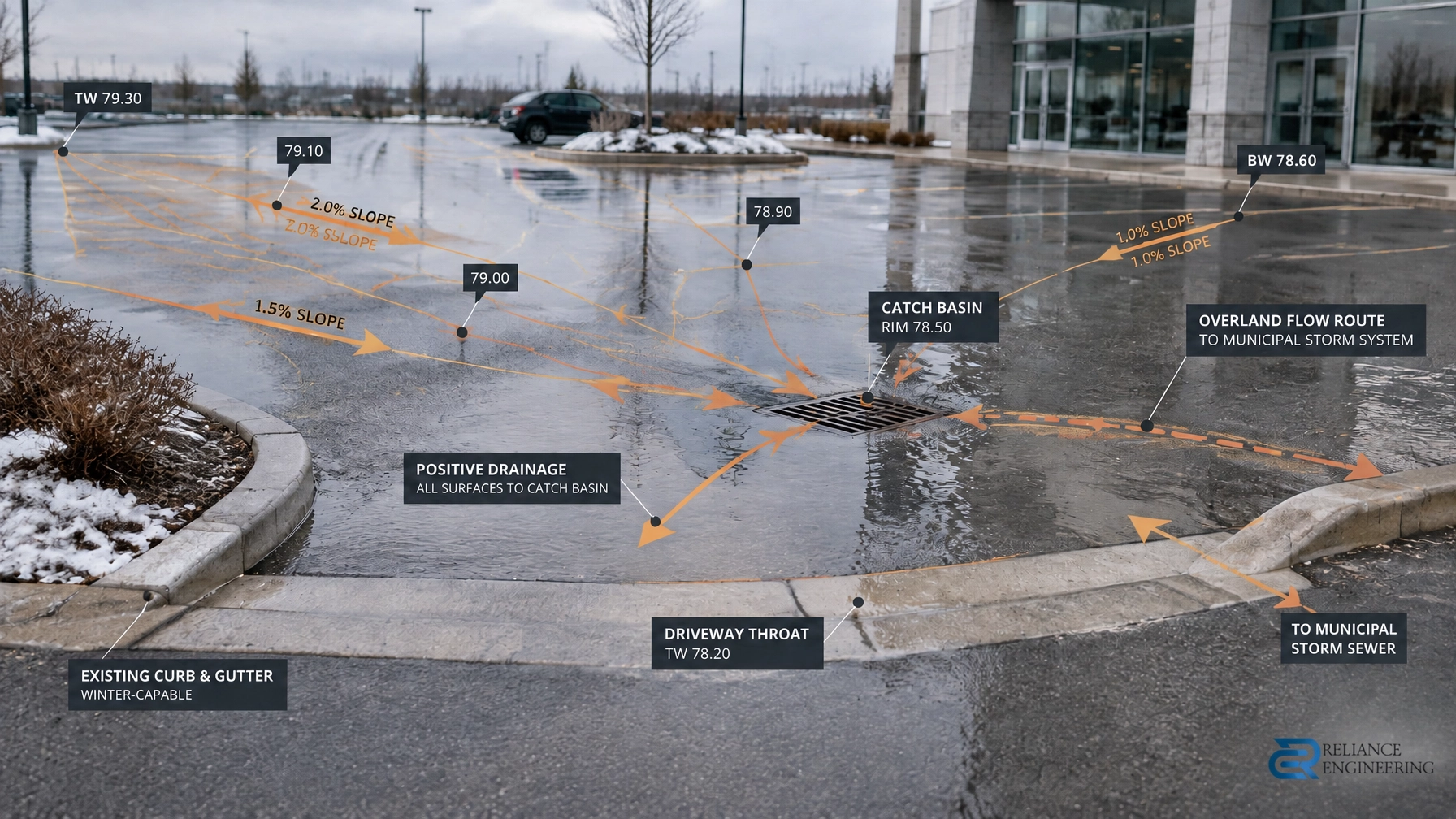
- Can each proposed lot achieve positive drainage?
- Are road grades practical for access, snow clearing, and construction?
- Can sanitary sewers reach an available outlet?
- Is there sufficient water capacity and fire protection?
- Can stormwater be controlled within the proposed lands?
- Are downstream drainage constraints understood?
- Will external road or servicing works be required?
- Are easements wide and correctly positioned?
- Can the subdivision be phased without creating interim servicing problems?
- Will grading affect neighbouring properties?
- Can driveway tie-ins be constructed without creating steep or unsafe entrances?
These questions influence the number of lots that can be created, the position of roads, the cost of infrastructure, and the timing of municipal review.
Early review also allows the project team to compare practical concepts rather than redesigning a detailed application after comments have been received. This is one of the most effective ways to keep a draft plan of subdivision moving.
Site Grading Plans Create Buildable Lots
Subdivision grading must establish a buildable relationship between lots, roads, sidewalks, rear yards, drainage blocks, stormwater facilities, and adjacent lands.
A coordinated Site Grading Plan may include:
- Existing and proposed elevations
- Road centreline grades
- Lot corner elevations
- Finished floor elevations
- Driveway and entrance grades
- Sidewalk and walkway grades
- Swales and drainage arrows
- Rear-yard drainage
- Catchbasins and area drains
- Retaining wall coordination
- Major overland flow routes
- Tie-ins to adjacent properties and roads
The objective is not simply to place elevations on a drawing. The grading must be practical to construct, maintain positive drainage, reduce unnecessary retaining, and protect neighbouring properties.
Subdivision grading must also coordinate with building envelopes. Lot elevations can influence basement elevations, driveway slopes, garage access, foundation design, and future building permit submissions.
Site Servicing Plans Connect Every Lot to Infrastructure
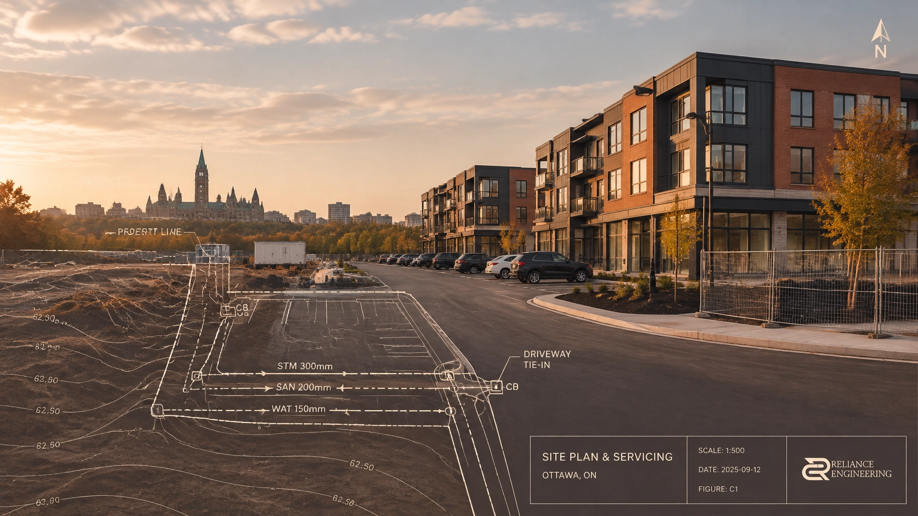
A Site Servicing Plan shows how proposed lots and blocks will connect to municipal or private water, sanitary, and storm infrastructure.
The design may include:
- Watermain alignment
- Hydrants, valves, and service connections
- Sanitary sewers and laterals
- Manholes and maintenance access
- Storm sewers and catchbasins
- Pipe sizes, slopes, and inverts
- External servicing connections
- Utility corridors and easements
- Crossing and clearance information
- Construction notes and details
Servicing must be coordinated with road alignments, grading, fire access, stormwater facilities, utility requirements, and municipal standards.
For example, a sewer alignment may appear practical on a draft plan but fail to provide sufficient slope once road grades and existing connection elevations are reviewed. An easement may also need to be widened or relocated to provide access for municipal infrastructure.
Clear drawings help reviewers and contractors understand the proposed infrastructure without searching through unrelated sheets.
Stormwater Management Must Work with the Layout
Stormwater management is a central part of subdivision approval in Ontario. The civil package must show how runoff will be collected, controlled, treated, conveyed, and safely released.
A Stormwater Management Report may address:
- Pre- and post-development drainage areas
- Peak flow calculations
- Quantity control storage
- Allowable release rates
- Water quality treatment
- Infiltration or water balance considerations
- Stormwater management ponds or underground facilities
- Outlet controls and downstream connections
- Overland flow routes
- Protection of adjacent properties
The stormwater strategy must match the grading and servicing drawings. A proposed pond, drainage block, underground tank, or outlet is only practical if it can be connected to the surrounding grades and infrastructure.
A Functional Servicing Report may also be required for larger or more complex projects. It provides a broader assessment of water supply, sanitary capacity, storm drainage, roads, external works, and servicing phasing.
Erosion and Sediment Control Protects the Construction Phase
Subdivision construction can expose large areas of soil. Without suitable controls, sediment can enter municipal catchbasins, storm sewers, ditches, watercourses, and neighbouring properties.
An Erosion and Sediment Control Plan may show:
- Construction access and mud mats
- Silt fencing
- Catchbasin protection
- Sediment traps and check dams
- Stockpile protection
- Construction limit fencing
- Dewatering measures
- Site stabilization requirements
- Inspection and maintenance notes
- Construction sequencing
ESC measures should be coordinated with the grading plan, drainage areas, construction limits, road construction, and stormwater design. Standard notes alone may not reflect actual site conditions.
Practical controls are easier for contractors to install, inspect, and maintain. They also provide clearer information for municipal and conservation authority review.

Roads, Driveway Tie-Ins, and Easements Require Strong Coordination
Road design affects almost every part of the subdivision civil package. Horizontal alignment and vertical grades influence:
- Lot depths and frontages
- Drainage patterns
- Sanitary sewer slopes
- Storm sewer connections
- Watermain locations
- Driveway grades
- Sidewalk accessibility
- Snow storage and maintenance
- Construction staging
Road and driveway tie-ins must connect safely to existing streets and proposed lots. The design should consider curb grades, entrances, ditches, culverts, sidewalks, catchbasins, and transitions to existing conditions.
Easements also require early attention. Municipal servicing, drainage, emergency access, utilities, and maintenance requirements may each require designated corridors. Incorrectly placed or undersized easements can create conflicts during detailed design and registration.

Reviewer-Friendly Drawings Reduce Avoidable Comments
Municipal review is more efficient when technical information is clear, consistent, and easy to verify.
Reviewer-friendly drawings should include:
- Consistent metric scales
- Legible labels and lineweights
- Clear title blocks
- Logical sheet numbering
- Revision dates and descriptions
- Coordinated north arrows and key plans
- Clear existing and proposed conditions
- Consistent terminology across drawings and reports
- Details that match the plan
- Cross-references between grading, servicing, stormwater, and ESC sheets
The goal is to make the design logic apparent. A reviewer should be able to trace a drainage route, servicing connection, road grade, or easement without comparing conflicting information across several documents.
This is the value of a complete civil package. Grading, servicing, stormwater, and erosion control should function as one coordinated design rather than as separate drawings prepared independently.
Subdivision Drawings Support Later Approval Stages
A plan of subdivision is often one stage in a longer development process. Reliable civil information can support later applications, including:
For example, lot grading decisions made during subdivision design can influence building locations, basement elevations, driveway connections, stormwater outlets, and servicing routes. Early coordination reduces the need to restart the design when individual lots or blocks advance to construction.
How Reliance Engineering Supports Subdivision Projects
Reliance Engineering provides civil engineering and land development consulting services from concept review through municipal coordination and detailed design.
Our process includes:
- Reviewing the survey, draft plan, concept layout, and municipal requirements.
- Identifying grading, servicing, stormwater, road, and infrastructure constraints.
- Developing practical concepts that support the proposed lot and road arrangement.
- Coordinating the civil design with the project team.
- Preparing clear drawings and supporting reports.
- Responding to municipal engineering comments.
- Advancing the design toward permit-ready civil drawings.
With more than 20 years of Principal Engineer experience, Reliance Engineering understands the importance of early coordination, technical accuracy, and responsive approval support.
Discuss Your Plan of Subdivision in Ontario
If you are preparing a new subdivision, revising a draft plan, or responding to municipal comments, early civil engineering input can improve the quality and efficiency of the approval process.
Request a consultation with Reliance Engineering to discuss your project and determine the drawings, reports, and coordination required.
Professional Contact Information
Reliance Engineering Canada Limited
6850 Millcreek Dr, Mississauga, ON L5N 2H4
Phone: 647-385-6418
Email: [email protected]
Principal Engineer: Naresh Ochani, P.Eng. M.Eng.
PEO Certificate of Authorization: 100548882
Office hours:
Monday–Friday: 9:00 AM–5:00 PM
Saturday: 12:00 PM–2:00 PM
Sunday: Closed
Reliance Engineering is authorized by the Professional Engineers of Ontario to offer professional engineering services across Ontario.