Series: Ontario Land Development, Zoning & Approvals
Publication slot: 6:00 PM
Published: September 21, 2026
Reading time: 7 minutes
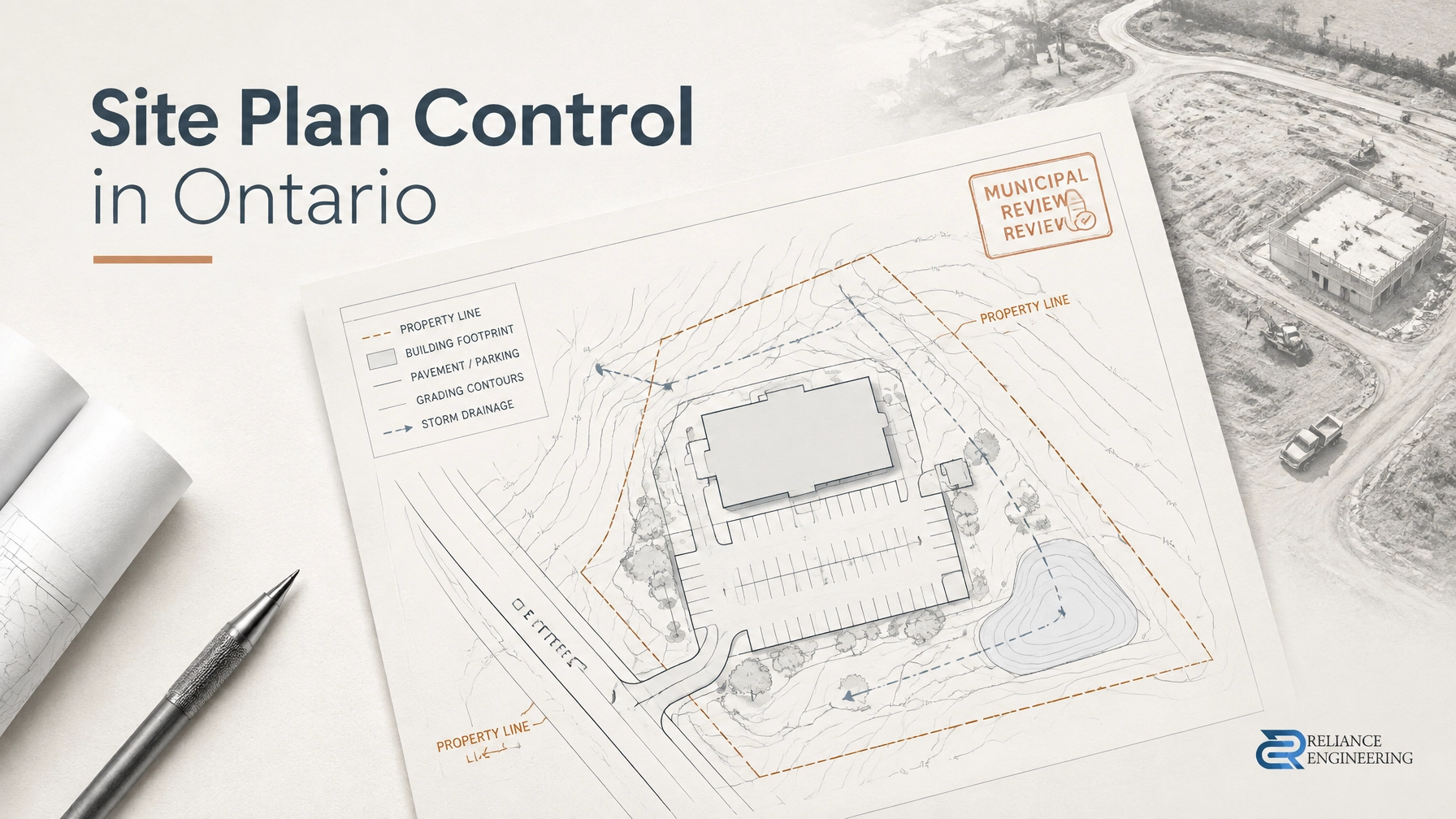
Site plan control is an Ontario-wide planning approval tool administered by the local municipality. Under Section 41 of the Planning Act, municipalities can review detailed site elements such as building placement, access, parking, drainage, servicing, landscaping, and site function.
Depending on the project and jurisdiction, the review may involve the local municipality, an upper-tier or regional municipality, municipal planning staff, the engineering or development engineering department, the building department, the Fire department, utilities, and the applicable Conservation Authority.
A site plan application is not approved because the building fits on the property. It is approved when the entire site is demonstrated to be functional, serviceable, accessible, drainable, and buildable.
That is why a complete civil package is central to successful site plan approval.
What a Complete Civil Package Includes
Municipal engineering reviewers need to understand how the proposed development will connect to surrounding infrastructure and operate after construction. A coordinated submission typically includes the following.
1. Site Grading Plan
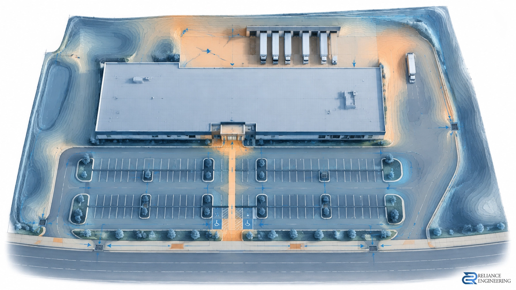
The site grading plan shows how the land will be shaped and drained. It should identify:
- Existing and proposed elevations
- Finished floor and entrance elevations
- Spot grades and slope arrows
- Swales and positive drainage routes
- Overland flow routes
- Retaining wall coordination, where applicable
- Tie-ins to adjacent properties
- Road, ditch, and right-of-way connections
- Driveway, walkway, and parking grades
- Catchbasins and area drains
Municipal reviewers look closely at property-line tie-ins. Proposed grades should not simply stop at the boundary. They must demonstrate how the site connects to existing grades without creating ponding, erosion, unsafe access, or drainage impacts on neighbouring properties.
2. Site Servicing Plan
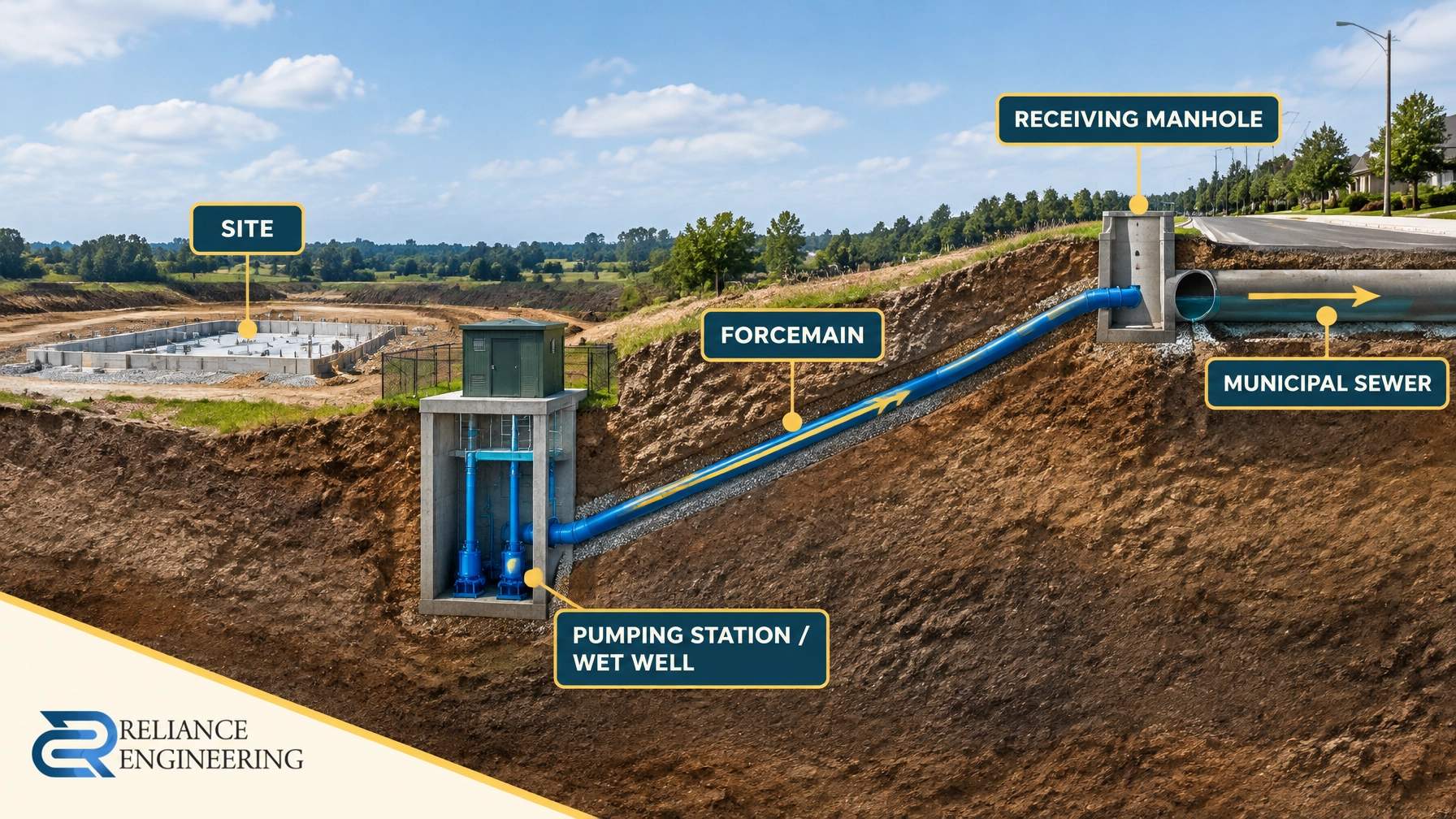
Site servicing plans show how the development will connect to water, sanitary, and storm infrastructure.
A reviewer will typically expect to see:
- Water service connection and meter arrangements
- Sanitary laterals, cleanouts, and manholes
- Storm sewer connections and outfalls
- Pipe sizes, slopes, and invert elevations
- Catchbasins and maintenance access
- Existing service abandonment or decommissioning notes
- Utility clearances
- Easements and municipal infrastructure
- Fire flow and water supply coordination, where required
The servicing layout must be coordinated with the building footprint, underground structure, landscape areas, fire route, parking, waste facilities, and proposed grades.
A pipe connection that works on paper may not work in the field if it conflicts with a foundation, retaining wall, landscape feature, accessible route, or required cover.
3. Storm Drainage and Overland Flow
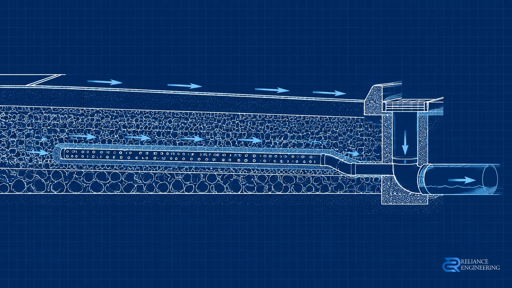
Storm drainage must be shown as part of the overall site function. Reviewers need to know where runoff goes during minor and major storm events, including when the underground storm system reaches capacity.
The civil package should identify:
- Roof and surface drainage
- Catchbasin locations
- Storm sewer routing
- Emergency overland flow routes
- Low points and ponding areas
- Safe discharge points
- Property-line drainage conditions
- Connection to municipal systems or approved outlets
An unclear drainage path is a common reason for municipal engineering comments. A site may have adequate catchbasins but still fail review if the overland route is not defined or if the major storm flow moves toward a building entrance, adjacent property, or public sidewalk.

4. Stormwater Management Report
A stormwater management report explains how the proposed site will collect, control, treat, and release runoff.
Depending on the municipality, project type, and site conditions, the report may address:
- Pre- and post-development runoff
- Quantity control
- Quality treatment
- Allowable release rates
- Storage requirements
- Outlet and orifice controls
- Low Impact Development measures
- Water balance
- Downstream capacity
- Major system flow
- Conservation Authority criteria
The report must match the drawings. Storage volumes, outlet controls, drainage areas, catchbasin locations, grading, and discharge points should be consistent across the SWM report, grading plan, servicing plan, and architectural site plan.
This is a key distinction: the report demonstrates criteria compliance, while the drawings show how the design will be constructed.
5. Erosion and Sediment Control Plan
An erosion and sediment control plan protects surrounding properties, municipal infrastructure, waterways, and construction areas during site disturbance.
It may include:
- Silt fencing
- Construction entrances
- Mud tracking controls
- Temporary sediment traps
- Check dams
- Inlet protection
- Stockpile controls
- Construction sequencing
- Inspection and maintenance notes
- Restoration requirements
An ESC plan may be required by the municipality, Conservation Authority, or both. Omitting it from the initial submission can create avoidable review delays.
6. Civil Notes and Details
Civil notes and details provide construction direction. They may cover:
- Road and driveway tie-ins
- Curb and gutter interfaces
- Utility crossings
- Trench restoration
- Catchbasin connections
- Accessible routes
- Construction requirements
- Testing and inspection
- Protection of existing infrastructure
These details help transform a concept into permit-ready civil drawings that contractors, reviewers, and inspectors can understand.
Common Comment Triggers That Stall Approval
Many site plan applications are delayed because the individual drawings appear complete but are not coordinated. Common comment triggers include:
-
Missing grading tie-ins
Grades do not connect clearly to property lines, roads, adjacent lots, or existing drainage conditions. -
Unclear drainage paths
The plan shows catchbasins but does not explain emergency overland flow or major storm routing. -
Servicing conflicts with the architectural footprint
Water, sanitary, or storm connections conflict with foundations, underground parking, loading areas, or landscape features. -
Driveway and access concerns
Driveway grades, right-of-way tie-ins, accessible routes, fire access, or sightline requirements are not demonstrated. -
Insufficient SWM documentation
The SWM report does not explain municipal criteria, storage, release rates, quality treatment, or outlet conditions. -
Missing erosion and sediment control measures
ESC is absent, incomplete, or not coordinated with construction phasing. -
Coordination gaps with landscape and architectural plans
Grading does not support proposed planting areas, accessible walkways, tree preservation, retaining walls, waste areas, or surface materials.
These issues often force the architect, planner, landscape architect, and civil engineer to redesign portions of the site after the first municipal review.
Early Engineering Input Prevents Late Redesign
The most effective time to involve civil engineering is before the architect finalizes the site plan.
Early engineering input allows the team to identify:
- Available municipal service connections
- Site grading limitations
- Stormwater storage requirements
- Overland flow constraints
- Driveway and access grades
- Easement and utility conflicts
- Conservation Authority considerations
- Retaining wall or underground structure impacts
- Required right-of-way improvements
This helps the team develop practical concepts before the building footprint, parking layout, landscape plan, and access arrangement become difficult to change.
Civil engineering should shape the layout rather than react to it at the end. Early coordination reduces the risk of discovering that the proposed building is too low for the available storm connection, that the driveway cannot meet grade requirements, or that SWM storage removes a required parking or landscape area.

How SPA Drawings, BP Drawings, FSRs, and SWM Reports Work Together
These documents serve different purposes but should be developed as one coordinated civil strategy.
Site Plan Approval Drawings
Site plan approval drawings support municipal site plan control review. They show the proposed, buildable arrangement of the site, including grading, servicing, drainage, access, utilities, easements, and civil details.
SPA/BP Drawings
SPA/BP drawings are often used to describe a coordinated civil drawing set that supports both site plan approval and building permit applications. The drawings may be similar, but the submission purpose is different.
SPA drawings focus on municipal site function and approval conditions. Building permit drawings must align with the approved site plan and provide the technical civil information required for the permit and construction process.
Functional Servicing Report
A functional servicing report provides capacity evidence. It explains whether available water, sanitary, and storm infrastructure can support the proposed development and identifies upgrades or connection requirements.
In simple terms:
- FSR: Can the site and surrounding infrastructure support the development?
- SWM report: Does the stormwater strategy meet the applicable criteria?
- SPA drawings: How will the approved site be graded, serviced, drained, and built?
The strongest submissions keep these documents consistent.
The Civil Package Scales to Other Approval Applications
A coordinated civil approach is also valuable when site plan approval is combined with another planning application.
For land severance Ontario applications, grading, access, drainage, and servicing information can demonstrate whether proposed lots are functional and independently serviceable. For OPA ZBA drawings, civil input can identify servicing, access, stormwater, and development constraints before a policy or zoning change is finalized.
For larger developments, the same technical framework can support a plan of subdivision, including road grades, servicing corridors, stormwater facilities, easements, and municipal right-of-way connections.
How Reliance Engineering Supports Site Plan Approval
Reliance Engineering’s Site Plan Approval Drawings process is structured around coordination and approval support:
-
Submission review
We review the municipal checklist, pre-consultation comments, survey, architectural site plan, and available servicing information. -
Civil design
We prepare grading, servicing, storm drainage, stormwater management coordination, ESC plans, and civil notes and details. -
Consultant coordination
We coordinate with architects, planners, landscape architects, surveyors, structural engineers, utility providers, and other project consultants. -
Comment response
We revise the package and provide clear technical responses to municipal engineering and development engineering comments through to approval.
The objective is a complete civil package with reviewer-friendly drawings, strong coordination, practical designs, and clear approval support.

Start With a Coordinated Civil Package
A site plan application should not be submitted with grading, servicing, stormwater, and access treated as separate tasks. Municipal approval depends on how these systems work together.
If you need site plan approval drawings, site servicing plans, stormwater management reports Ontario projects, functional servicing support, OPA/ZBA drawings, severance drawings, or building permit drawings, Reliance Engineering can help develop a coordinated submission.
Request a consultation through Reliance Engineering or contact us directly:
Reliance Engineering
6850 Millcreek Dr, Mississauga, ON L5N 2H4
Phone: 647-385-6418
Email: [email protected]
Website: relianceengineering.ca
Office hours:
Monday–Friday: 9:00 AM–5:00 PM
Saturday: 12:00 PM–2:00 PM
Sunday: Closed
Professional credentials:
Naresh Ochani, P.Eng. M.Eng.
PEO Certificate of Authorization: 100548882